Our verdict
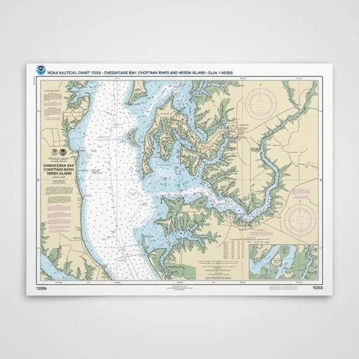
The NOAA Nautical Chart remains an essential, reliable navigational tool for boaters who want a dependable backup to electronic systems. Its official soundings, hazard markings, and aids to navigation make it indispensable for safe passage planning, though mariners should ensure they use the most recent edition and protect it from water damage.
Why it made the list
- Official NOAA accuracy
- Reliable backup navigation
- Detailed coastal hazards
Pros & cons
What we like
- Trusted official source for safe navigation
- Highly detailed depth and hazard information
- Works without batteries or electronic failure
- Legal requirement backup for many vessels
- Covers wide range of coastal and harbor areas
- Affordable compared to electronic chartplotter subscriptions
Watch out for
- Large paper size can be cumbersome on small boats
- Needs periodic manual updates to stay current
- Not interactive like digital GPS chartplotters
- Can be damaged by water if not laminated
- Folding/storage can degrade chart over time
Spec sheet
| Scale | 1:40,000 (varies by region) |
|---|---|
| Paper Type | Weather-resistant printed stock |
| Chart Datum | NAD 83 / WGS 84 |
| Coverage Area | U.S. coastal and harbor waters |
| Update Frequency | Per Local Notice to Mariners |
Features at a glance
- Full-scale official NOAA navigational chart
- Depth soundings in feet or fathoms with datum notes
- Aids to navigation, buoys, and lighthouse markings
- Coastal contours, hazards, and restricted zones
- Latitude/longitude grid with compass rose
- Printed on durable weather-resistant paper
- Updated per Local Notice to Mariners schedule
Full review
The NOAA nautical chart remains the gold standard for marine navigation, offering boaters, sailors, and commercial operators a precise, government-sourced representation of coastal and inland waterways across the United States. Produced by the National Oceanic and Atmospheric Administration, each chart details critical information including water depths, shoreline contours, navigational aids, buoy placements, submerged hazards, and port facilities. Printed on durable, water-resistant paper or available in large-format sizes for chart tables, these charts are built to withstand the demands of life at sea, whether tucked into a cockpit chart holder or spread across a navigation station. Their reputation for accuracy and reliability has made them a trusted companion for generations of mariners who understand that paper charts never suffer a dead battery or lost GPS signal.
Every NOAA chart is meticulously surveyed and regularly updated to reflect changing channel depths, newly identified wrecks, shifting sandbars, and updated regulatory zones, ensuring that boaters are working with the most current data available. The charts cover an extensive range of regions, from the rocky inlets of New England to the barrier islands of the Gulf Coast, the Great Lakes, Alaskan waterways, and Pacific coastal routes, giving recreational and professional sailors alike the detailed geographic context needed for safe passage planning. Scale options vary by chart, allowing users to select harbor-level detail for tight maneuvering near marinas or broader coastal views for open-water passages, making it easy to match the chart to the specific demands of a voyage.
Beyond their navigational function, NOAA nautical charts serve as an essential backup to electronic chartplotters and GPS systems, providing a dependable, non-digital reference that many boaters consider a legal and practical necessity aboard. Compact enough to fold and store in a dry bag or chart case, yet detailed enough to support precise plotting with parallel rulers and dividers, these charts bridge traditional seamanship with modern boating practice. For anyone outfitting a vessel with essential navigation tools, a NOAA nautical chart delivers the confidence of proven accuracy, the practicality of an offline backup, and the enduring satisfaction of chart-and-compass navigation that has guided mariners safely for generations.
Ready to rig it?
NOAA Nautical Chart (Official Raster/Print Edition)
Check today's price and availability on Amazon.